Forum’s Key Lake Road project comprises two separate properties: Highrock and Costigan. The properties are located south of Cameco’s Key Lake deposits, and are underlain by rocks that host all the known uranium deposits in the eastern Athabasca Basin. The two projects host the graphitic conductor that hosts the Key Lake deposits, with Costigan hosting the west side of the conductor, and Highrock the east side. Targets along the conductor are determined by cross-cutting structures and gravity lows that may signify alteration. Both projects lie just to the south of the Athabasca sandstone limit, so the target is basement-hosted uranium mineralization.
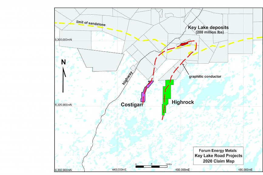
Figure 1: Key Lake Road Area ProjectsThese 2 projects cover an area 12 km from north to south, and along two main conductive zones over a 10 km width. The road to the Key Lake mine site runs approximately 6 km west of the Costigan property, and a winter trail was opened to the Highrock property in 2016 for a drill program, and further ground gravity in 2017. These projects have been on hold, waiting for the price of uranium to increase again.